
Environment
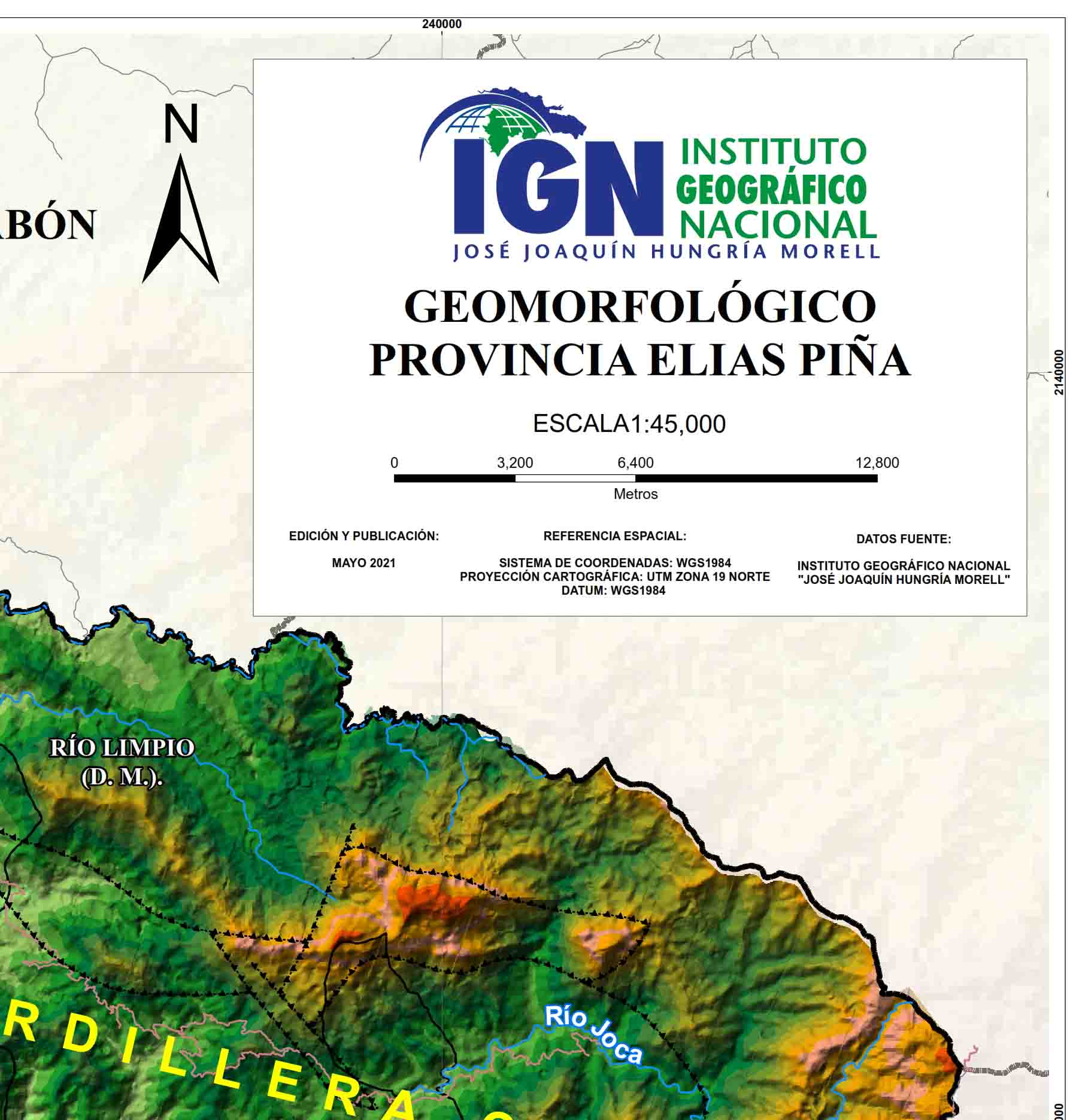
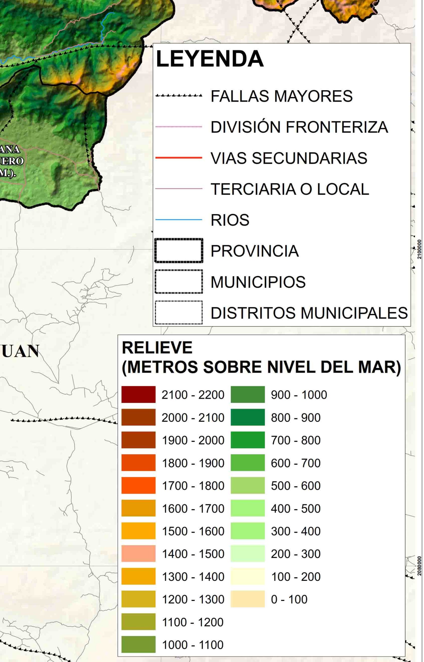
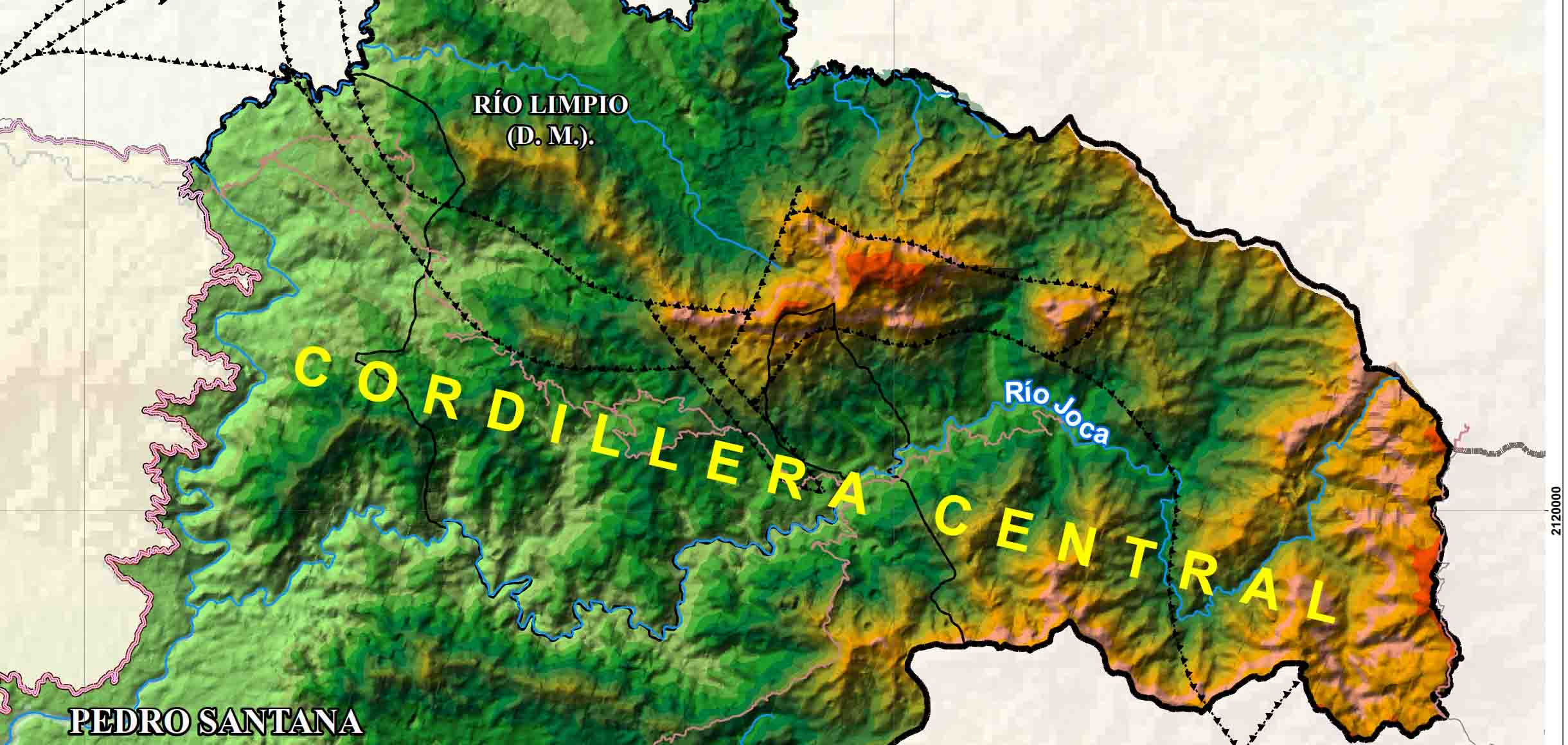
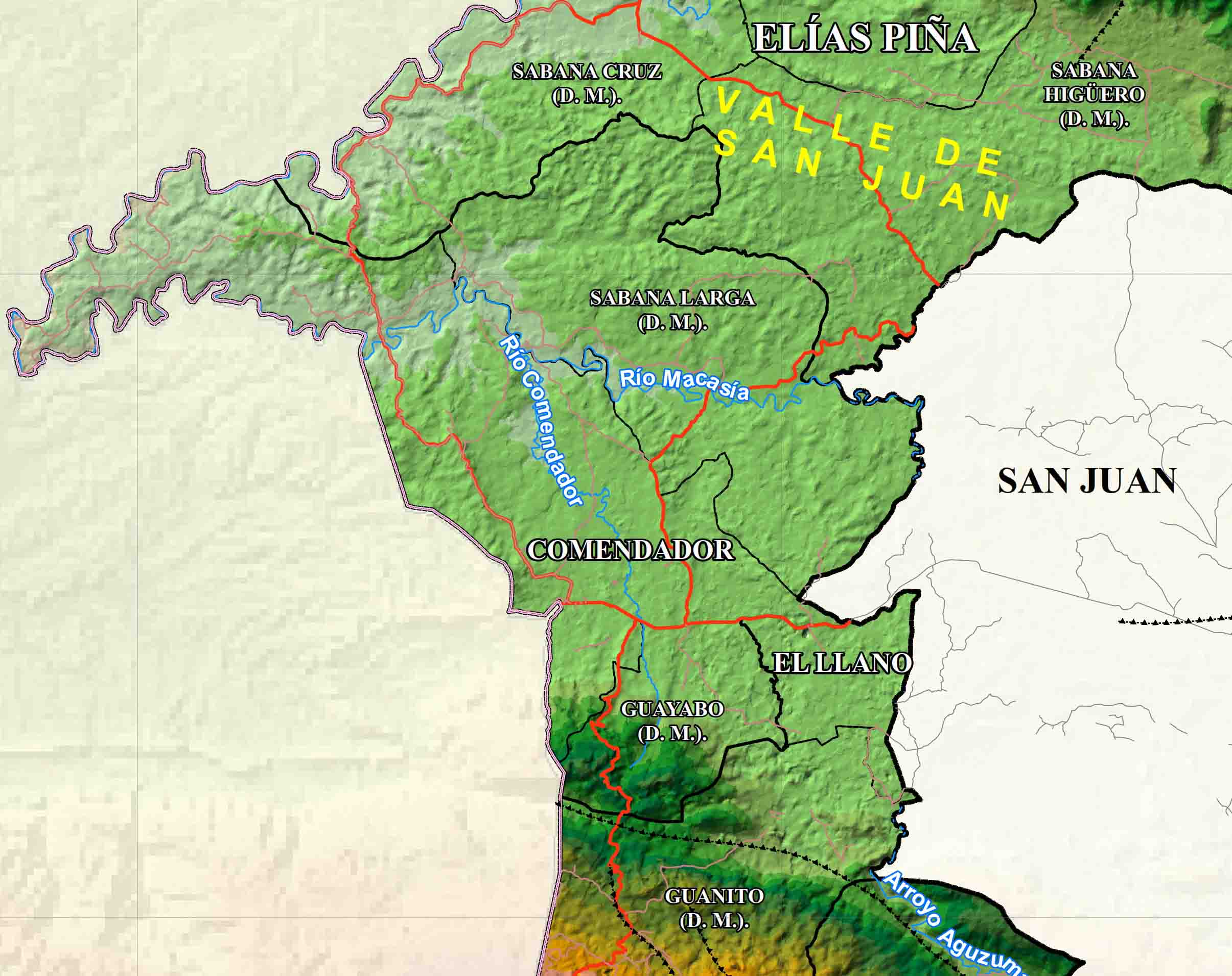
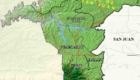
Elías Piña Province Geomorphological Map
Geomorphological map of the Elías Piña province, which provides information on the forms and physical characteristics of the relief that the land surface has. Useful for planning, land use planning and disaster risk management, among others.
Metadata in process of elaboration.
Entity: IGN-JJHM
Date: May 2021
License: CC Attribution 4.0 International.
National Geographic Institute – “José Joaquín Hungría Morell”
Published 28-11-2021
