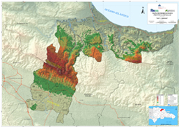
Environment
Espaillat Province Geomorphological Map
Geomorphological map of the Espaillat province, which provides information on the forms and physical characteristics of the relief that the land surface has. Useful for planning, land use planning and disaster risk management, among others.
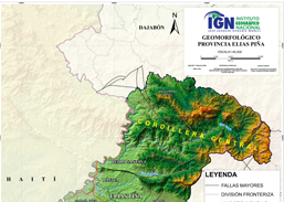
Environment
Elías Piña Province Geomorphological Map
Geomorphological map of the Elías Piña province, which provides information on the forms and physical characteristics of the relief that the land surface has. Useful for planning, land use planning and disaster risk management, among others.
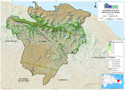
Environment
El Seibo Province Geomorphological Map
Geomorphological map of the El Seibo province, which provides information on the forms and physical characteristics of the relief that the land surface has. Useful for planning, land use planning and disaster risk management, among others.
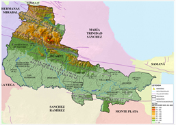
Environment
Duarte Province Geomorphological Map
Geomorphological map of the Duarte province, which provides information on the forms and physical characteristics of the relief that the land surface has. Useful for planning, land use planning and disaster risk management, among others.
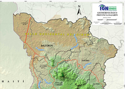
Environment
Dajabón Province Geomorphological Map
Geomorphological map of the Dajabón province, which provides information on the forms and physical characteristics of the relief that the land surface has. Useful for planning, land use planning and disaster risk management, among others.
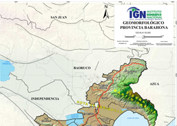
Environment
Barahona Province Geomorphological Map
Geomorphological map of the Barahona province, which provides information on the forms and physical characteristics of the relief that the land surface has. Useful for planning, land use planning and disaster risk management, among others.
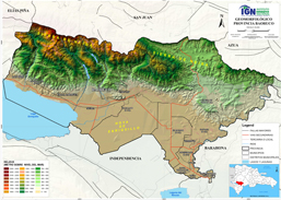
Environment
Baoruco Province Geomorphological Map
Geomorphological map of the Baoruco province, which provides information on the forms and physical characteristics of the relief that the land surface has. Useful for planning, land use planning and disaster risk management, among others.
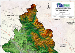
Environment
Azua Province Geomorphological Map
Geomorphological map of the Azua province, which provides information on the forms and physical characteristics of the relief that the land surface has. Useful for planning, land use planning and disaster risk management, among others.